Click on the map to see the detail.
Total
Checkout
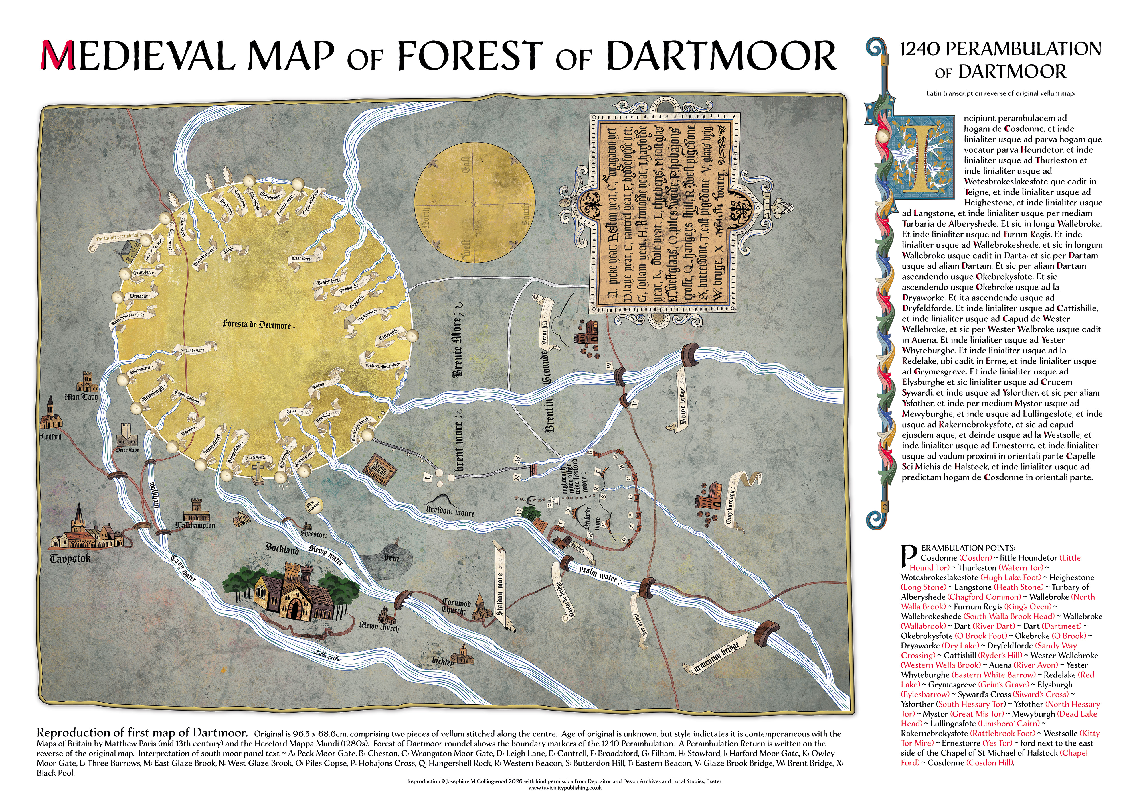
MEDIEVAL MAP of the FOREST of DARTMOOR and 1240 PERAMBULATION
This is a detailed reproduction of the first map of Dartmoor, currently held in archive, but estimated to be late 13th century or 14th century. Dartmoor is represented by a roundel showing each of the 1240 Perambulation way-markers. Churches, tracks, bridges, rivers and features of the south moor are shown, including the moor gates that allowed grazing access to the Royal Forest. Spellings and visuals are as close to original as possible (some parts of the map are undecipherable through damage). This is an extraordinary map with place names that have survived over 700 years, and some that have not and remain a mystery to this day.
The poster includes the Latin transcript of a 1240 Perambulation Return that is written on the reverse of the original map. Beneath is is list of the Perambulation way-markers and present-day name. A translation of the 'Yeats' or south moor gates is also provided.
Map Reproduction and Design © Josephine M Collingwood 2026.
See details in gallery below ↓
A2 PRINT
Printed on A2 matt white silk paper 300gsm, media size: 594x 420mm.
Print is rolled in smooth acid-free tissue and glassine, and posted in cardboard tube.
BUY NOW WITH 10% Discount: £18.00
P&P £4.55 (UK only). See postage details here.
£20
BUY NOW
Add to Basket
StyleName


Original Map of Dartmoor Forest, courtesy of Depositor and Devon Archives and Local Studies, Exeter.
Original detail of Buckland Abbey.
Reproduction showing Buckland Abbey.
Original showing North west corner of Dartmoor Perambulation.
Reproduction showing North west corner of Dartmoor Perambulation.
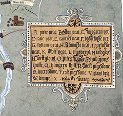
Original detail of south Dartmoor Yeats (gates).
Reproduction showing south Dartmoor Yeats (gates).
You successfully added the item to the basket!
Beautiful, meticulous Dartmoor books, maps & imagery.
07855 015110
enquiries@tavicinitypublishing.co.uk